
Where Is Lake Oconee, Georgia? Location, Size and Key Facts
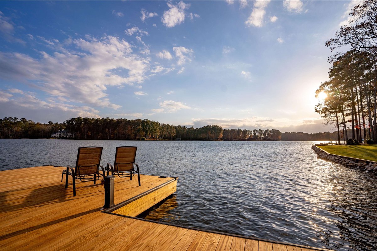
Lake Oconee is a 19,050-acre lake in central Georgia, about 80 miles east of Atlanta and 80 miles west of Augusta, with I-20 crossing its north end. Georgia Power created it with Wallace Dam on the Oconee River in 1979, and its 374 miles of shoreline run through Greene, Putnam, Morgan and Hancock counties.
Key facts: where Lake Oconee is
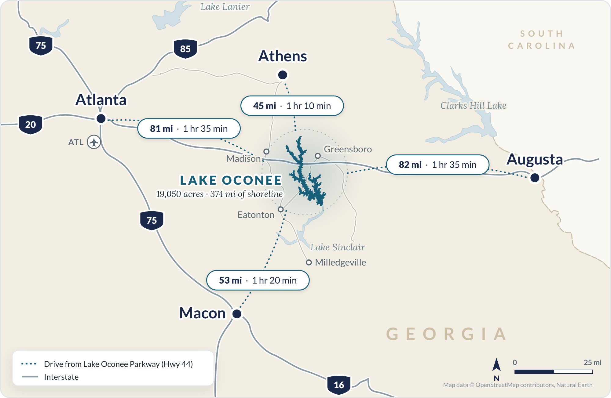
- Lake Oconee is about 81 miles east of downtown Atlanta and 82 miles west of Augusta by road, roughly 1 hour 35 minutes from each.
- Three I-20 exits lead to the lake: Exit 114 at Madison, Exit 121 at Buckhead and Exit 130 at Greensboro, which puts you on Highway 44.
- The lake touches four counties, Greene, Putnam, Morgan and Hancock, but every home on it is in Greene, Putnam or Morgan County.
- There is no town called Lake Oconee: homes use Greensboro, Eatonton, Buckhead, Madison or White Plains addresses.
- Lake Oconee is man-made. Georgia Power created it with Wallace Dam on the Oconee River, and it reached full pool in May 1980.
- It covers about 19,050 acres with 374 miles of shoreline, according to Georgia Power.
Lake Oconee at a Glance
| Fact | Figure |
|---|---|
| Location | Central Georgia, on I-20, halfway between Atlanta and AugustaMapped drive routes, 2026 |
| Surface area | About 19,050 acres at full poolGeorgia Power, 2015 |
| Shoreline | 374 milesGeorgia Power, 2015 |
| Length | About 39 river miles up the Oconee RiverGeorgia Power, 2017 |
| Depth | 21 feet average, about 120 feet maximumGeorgia Power, 2017 |
| Counties | Greene, Putnam, Morgan and HancockGeorgia Power, 2015 |
| Rivers | Oconee and ApalacheeGeorgia Power, 2017 |
| Dam | Wallace Dam, 2,395 feet long and 118 feet highGeorgia Power, 2015 |
| Opened | December 1979; full pool by May 1980Georgia Power, 2017 |
| Owner | Georgia PowerGeorgia Power, 2015 |
| Daily water level change | 1.5 feet on average, 2 feet at mostGeorgia Power, 2015 and 2017 |
| Zip codes | 30642, 31024, 30625, 30650, 30678Margie’s neighborhood guides |
Lake Oconee’s Location and I-20 Exits
Lake Oconee is in central Georgia’s Piedmont, almost exactly halfway between Atlanta and Augusta: 81 miles to downtown Atlanta and 82 to Augusta by road from Lake Oconee Parkway. I-20 crosses the north end of the lake, so while most of it lies south of the interstate, the upper river arms and their neighborhoods in Greene and Morgan counties sit north of it.
Three I-20 exits lead to Lake Oconee GA: Exit 114 (US 441, Madison), Exit 121 (Buckhead) and Exit 130 (Hwy 44, Greensboro). Exit 130 puts you on Highway 44, which runs straight down to the lake’s shopping and restaurants on Lake Oconee Parkway.
How Far Is Lake Oconee From Atlanta?
Lake Oconee is about 81 miles from downtown Atlanta, roughly 1 hour 35 minutes without traffic. The Morgan County side, near Buckhead, is about 10 miles closer.
| From Lake Oconee to | Miles | Drive |
|---|---|---|
| Greensboro | 10 | 15 min |
| Eatonton | 13 | 20 min |
| Madison | 27 | 35 min |
| Milledgeville | 29 | 50 min |
| Athens | 45 | 1 hr 10 min |
| Macon | 53 | 1 hr 20 min |
| Atlanta (downtown) | 81 | 1 hr 35 min |
| Augusta | 82 | 1 hr 35 min |
| Atlanta airport (ATL) | 85 | 1 hr 40 min |
| Savannah | 193 | 4 hr |
| Charlotte | 237 | 4 hr 30 min |
Measured by road from the Publix on Lake Oconee Parkway (Highway 44), without traffic and at the designated speed limit, October 2026.
What County Is Lake Oconee In?
Lake Oconee is in four counties: Greene, Putnam, Morgan and Hancock. Every home on the lake is in Greene, Putnam or Morgan; Hancock touches only a small corner at Wallace Dam.
- Greene County (Greensboro): the eastern and northern shore, including Harbor Club, much of Reynolds Lake Oconee, Richland and White Plains, and the north end above I-20.
- Putnam County (Eatonton): the western and southern shore along Highway 44, including Cuscowilla and Long Shoals. See Lake Oconee homes in Eatonton.
- Morgan County (Madison): the northwest corner around Buckhead and the Apalachee River arm. See Buckhead and Morgan County.
- Hancock County (Sparta): only a small corner at the southern tip, where Wallace Dam sits. No homes on Lake Oconee are in Hancock County.
What City Is Lake Oconee In? Lake Oconee Zip Codes
Lake Oconee isn’t in a city, and there’s no town called Lake Oconee. Homes take the mailing address of the nearest post office:
- 30642 Greensboro (Greene County)
- 31024 Eatonton (Putnam County)
- 30625 Buckhead (Morgan County)
- 30650 Madison (Morgan County)
- 30678 White Plains (Greene County)
The address doesn’t always match the county. Beau Rivage is in Greene County with a Madison address.
Is Lake Oconee Man-Made?
Yes, Lake Oconee is a man-made lake. Georgia Power created it by building Wallace Dam across the Oconee River. The dam began commercial operation in December 1979, and the lake reached full pool, 435 feet, by May 1980.
Wallace Dam is a pumped-storage plant. It releases water into Lake Sinclair, just downstream, to make electricity, then pumps water back up into Lake Oconee when power demand is low. That’s why the lake rises and falls about 1.5 feet a day. Before building a dock, read the Georgia Power shoreline rules.
How Big Is Lake Oconee?
Lake Oconee covers about 19,050 acres, with 374 miles of shoreline, an average depth of 21 feet and a maximum of about 120 feet. It’s the second-largest lake entirely inside Georgia, after Lake Lanier at about 38,000 acres. For water volume, drought levels and depth charts, see how big and how deep Lake Oconee is.
Why Other Sources Give Different Lake Oconee Numbers
Lake Oconee’s basic facts vary from site to site. This page uses Georgia Power’s figures from its federal relicensing filings for Wallace Dam.
- Three counties or four Most pages leave out Hancock, which touches only a small corner of the lake at the dam and has no lake homes.
- 19,071 or 19,971 acres Wikipedia gives both. Georgia Power’s figure is 19,050.
- 374 or 376 miles of shoreline Wikipedia gives both. Georgia Power’s figure is 374.
- 102 feet or “more than 100” Wikipedia lists 102 feet. Georgia Power puts the maximum at about 120.
- 20 miles long or 39 Wikipedia’s 20 miles has no source. In a straight line the lake runs about 23 miles; Georgia Power’s 39 follow the river channel.
- “Georgia’s second-largest lake” Only among lakes entirely inside Georgia. Several lakes Georgia shares with neighboring states are larger.
What Margie Tells People About Lake Oconee
I was born here. When someone asks me where Lake Oconee is, I always answer the same: about halfway between Atlanta and Augusta. I say the exact same thing about Greensboro, since the lake and the town share the same exit off I-20.
Sources
- Georgia Power, Scoping Document 1, Wallace Dam Pumped Storage Project (FERC No. 2413), April 2015
- Georgia Power, Preliminary Licensing Proposal, Wallace Dam Project, November 2017
- Recreation.gov, Sawnee Campground, Lake Sidney Lanier (Lanier’s 38,000 acres)
- Wikipedia, Lake Oconee, checked October 2026
- Drive distances: OpenStreetMap routing, October 2026
- Counties and zip codes: Margie Sorrell’s Lake Oconee neighborhood guides
Frequently Asked Questions About Lake Oconee, Georgia
Is Lake Oconee in North Georgia?
No. Lake Oconee is in central Georgia, about 80 miles east of Atlanta. With Lake Sinclair, the area is known as Georgia’s Lake Country.
Is Lake Oconee a public lake?
Yes. Anyone can boat, fish and swim on Lake Oconee. Georgia Power runs seven public recreation sites, six of them on the lake, with parks, beaches, campgrounds and boat ramps.
What is the closest major airport to Lake Oconee?
Hartsfield-Jackson Atlanta International Airport, about 85 miles and 1 hour 40 minutes from Lake Oconee without traffic.
Where does the name Oconee come from?
From the Oconee River, named for Oconee, a Hitchiti-speaking Native American town that stood on the river around 1700.
What is Lake Oconee known for?
Golf communities and lake homes, led by Reynolds Lake Oconee and The Ritz-Carlton Reynolds, plus Harbor Club and Cuscowilla. The gated golf communities are why people tend to think Lake Oconee is so expensive, but there are over a hundred other neighborhoods with price points to fit any buyer’s budget.
Does Lake Oconee’s water level change?
Yes, about 1.5 feet on an average day and never more than 2 feet, because of Wallace Dam’s pumped storage. Georgia Power normally keeps it between 433.5 and 435 feet all year, with no winter drawdown, though droughts have pulled it 4 to 5 feet below full pool.
Looking at Homes on Lake Oconee?
Greene or Putnam, river arm or open water, gated or no HOA: tell me what you’re after and I’ll help you find the part of Lake Oconee that fits.
